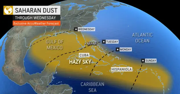
Over the past few days, meteorologists have been monitoring an increase in the Saharan Dust Layer coming off the African coast. This dust is expected to reach the western Caribbean and parts of Jamaica by early this week. This dust layer is commonly known as the Saharan Air Layer (SAL), this dry dust generally forms during the late spring through early fall months and moves across the Tropical Atlantic Ocean over a three to five days cycle, according to NOAA’s Hurricane Research Division (HRD).
Each year hundreds of millions of tons of dust are picked up from the deserts of Africa and blown across the Atlantic Ocean. This dust can severely affect air quality and results in harmful heat stress-related impacts on animals and plants.
According to NOAA, the SAL is most common during the early part of the hurricane season. This outbreak of dust along with unfavourable upper-level winds will likely put a lid on any significant tropical development over the next several weeks.
As we prepare for this round of Saharan dust early this week some persons may likely experience some minor respiratory irritation, while most will only notice some hazy and hot conditions. Nevertheless, we should take the necessary precautions to stay hydrated and avoid the heat by not staying out in direct sunlight, especially during the hours of 11 am to 3 pm each day.